 |  |  |  |
 |  |  |  |
 |  |  |  |
 |  |  |  |
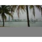 |  | 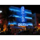 | 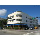 |
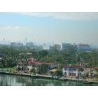
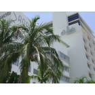
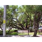
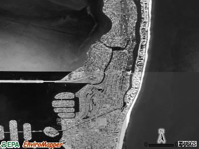
Submit pictures of this city
Click here for promotion details and to upload your Miami Beach, Florida photos
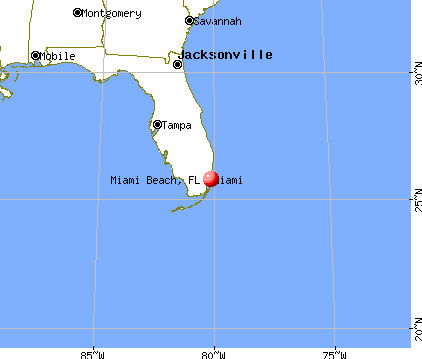
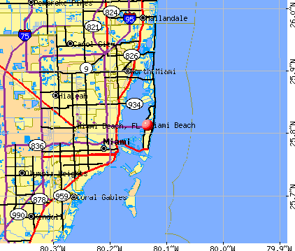 Current weather forecast for Miami Beach, FL
Population (year 2000): 87,933. Estimated population in July 2006: 86,916 (-1.2% change)
 |
| Males: 45,048 | |
| Females: 42,885 |
| Median resident age: | |
| Florida median age: |
Zip codes: 33109, 33139, 33140, 33141.
Estimated median household income in 2005: $33,763 (it was $27,322 in 2000)
| Miami Beach | |
| Florida: |
Estimated median house/condo value in 2005: $328,300 (it was $334,400 in 2000)
| Miami Beach | |
| Florida: |
Median gross rent in 2005: $821.
Percentage of residents living in poverty in 2005: 14.2%
Miami Beach, FL residents, houses, and apartments details
Profiles of local businesses:
Fabiola's airbrush tanning Inc
Infotel Distribution
Races in Miami Beach:
- Hispanic (53.4%)
- White Non-Hispanic (40.9%)
- Other race (4.0%)
- Black (4.0%)
- Two or more races (3.5%)
- American Indian (0.5%)
Ancestries: Italian (5.1%), United States (5.0%), German (4.3%), Russian (3.7%), Irish (3.3%), Polish (2.9%).
Elevation: 4 feet
Land area: 7.0 square miles.
| Population density: 12508 people per square mile | (very high). |
For population 25 years and over in Miami Beach
- High school or higher: 78.8%
- Bachelor's degree or higher: 33.5%
- Graduate or professional degree: 15.8%
- Unemployed: 7.4%
- Mean travel time to work: 25.6 minutes
For population 15 years and over in Miami Beach city
- Never married: 35.4%
- Now married: 38.0%
- Separated: 3.8%
- Widowed: 8.8%
- Divorced: 14.0%
48,852 residents are foreign born (45.2% Latin America, 7.6% Europe).
| This city: | |
| Florida: |
According to our research there were 29 registered sex offenders living in Miami Beach, Florida in early 2007.
The ratio of number of residents in Miami Beach to the number of sex offenders is 3034 to 1.
The number of registered sex offenders compared to the number of residents in this city is a lot smaller than the state average.
Median real estate property taxes paid for housing units with mortgages in 2005: $3,253 (1.0%)
Median real estate property taxes paid for housing units with no mortgage in 2005: $3,051 (0.9%)
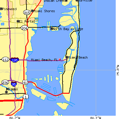
Nearest city with pop. 200,000+: Miami, FL  (6.4 miles
  , pop. 362,470).
Nearest city with pop. 1,000,000+: Philadelphia, PA (1039.2 miles  , pop. 1,517,550).
Nearest cities: North Bay Village, FL (2.6 miles  ), Fisher Island, FL (3.6 miles
  ), Surfside, FL (4.6 miles
  ), Indian Creek, FL (4.6 miles) , El Portal, FL (5.1 miles
  ), Bay Harbor Islands, FL (5.2 miles ), Miami Shores, FL (5.2 miles ), Bal Harbour, FL (5.6 miles ).
Daytime population change due to commuting: +6,897 (+7.8%)
Workers who live and work in this city: 15,623 (39.2%)
People in group quarters in Miami Beach
- 671 people in nursing homes
- 232 people in other noninstitutional group quarters
- 157 people in other group homes
- 125 people in wards in general hospitals for patients who have no usual home elsewhere
- 55 people in college dormitories (includes college quarters off campus)
- 46 people in military ships
- 30 people in homes for the mentally ill
- 8 people in military transient quarters for temporary residents
- 7 people in military barracks, etc.
- 3 people in religious group quarters
- 2 people in homes or halfway houses for drug/alcohol abuse
 |  |
Average climate in Miami Beach, Florida
Based on data reported by over 4,000 weather stations
 |  |
 |  |
 |  |
 |
Hospitals/medical centers in Miami Beach:
- MOUNT SINAI HOSPITAL (4300 ALTON RD)
- SOUTH SHORE HOSPITAL & MEDICAL CENTER (630 ALTON RD)
- DOUGLAS GARDENS HOSPITAL (about 4 miles; MIAMI, FL)
- ANNE BATES LEACH EYE HOSPITAL (about 6 miles; MIAMI, FL)
- CEDARS MEDICAL CENTER INC (about 6 miles; MIAMI, FL)
Political contributions by individuals in Miami Beach, FL
- MIAMI INTL (about 11 miles; MIAMI, FL; ID: MIA)
- FORT LAUDERDALE/HOLLYWOOD INTL (about 18 miles; FORT LAUDERDALE, FL; ID: FLL)
- PALM BEACH INTL (about 59 miles; WEST PALM BEACH, FL; ID: PBI)
- MIAMI (about 4 miles; MIAMI, FL; ID: X48)
- MIAMI (about 4 miles; MIAMI, FL; ID: X44)
- OPA LOCKA (about 11 miles; MIAMI, FL; ID: OPF)
- 9 miles: MIAMI (8303 N.W. 37TH AVE.). Services: ticket office, fully wheelchair accessible, enclosed waiting area, public restrooms, public payphones, vending machines, free short-term parking, call for car rental service, taxi stand, public transit connection.
- 11 miles: MIAMI INT'L AIRPORT (MIAMI, TRANSIT BUS LOADING AREA) - Bus Station
- 14 miles: HOLLYWOOD (3001 HOLLYWOOD BLVD.). Services: ticket office, partially wheelchair accessible, enclosed waiting area, public restrooms, public payphones, vending machines, free short-term parking, free long-term parking, taxi stand, public transit connection.
- TALMUDIC COLLEGE OF FLORIDA (Full-time enrollment: 51; Location: 1910 ALTON RD; Private, not-for-profit; Website: talmudicu.edu; Offers Doctor's degree)
- YESHIVAH GEDOLAH RABBINICAL COLLEGE (FT enrollment: 42; Location: 1140 ALTON RD; Private, not-for-profit; Offers Doctor's degree)
- MIAMI AD SCHOOL (FT enrollment: 9; Location: 955 ALTON RD; Private, for-profit; Website: www.adschool.edu)
- MIAMI-DADE COMMUNITY COLLEGE (about 5 miles; MIAMI, FL; Full-time enrollment: 25,323)
- BARRY UNIVERSITY (about 7 miles; MIAMI, FL; FT enrollment: 5,780)
- NOVA SOUTHEASTERN UNIVERSITY (about 19 miles; FT LAUDERDALE, FL; FT enrollment: 12,554)
- ART INSTITUTE OF FORT LAUDERDALE (about 20 miles; FT LAUDERDALE, FL; FT enrollment: 2,488)
- BROWARD COMMUNITY COLLEGE (about 22 miles; FT LAUDERDALE, FL; FT enrollment: 12,747)
- KEISER COLLEGE (about 26 miles; Ft. Lauderdale, FL; FT enrollment: 2,879)
- UNIVERSITY OF MIAMI (about 29 miles; CORAL GABLES, FL; FT enrollment: 13,050)
- MIAMI BEACH SENIOR HIGH SCHOOL (Students: 2,379; Location: 2231 PRAIRIE AVENUE; Grades: 09 - 12)
- RASG HEBREW ACADEMY OF GREATER (Students: 443; Location: 2400 PINETREE DRIVE; Grades: PK - 12)
- LANDOW YESHIVA (Students: 288; Location: 1140 ALTON ROAD; Grades: PK - 12)
- YESHIVA TORAS CHAIM (Students: 98; Location: 7141 INDIAN CREEK DRIVE; Grades: 7 - 12; Boys only)
- NAUTILUS MIDDLE SCHOOL (Students: 1,410; Location: 4301 N MICHIGAN AVENUE; Grades: 07 - 08)
- NORTH BEACH ELEMENTARY SCHOOL (Students: 1,166; Location: 4100 PRAIRIE AVENUE; Grades: PK - 06)
- BISCAYNE ELEMENTARY SCHOOL (Students: 1,095; Location: 800 77TH STREET; Grades: PK - 06)
- TREASURE ISLAND ELEMENTARY SCHOOL (Students: 1,057; Location: 7540 EAST TREASURE DRIVE; Grades: PK - 06)
- FIENBERG-FISHER ELEMENTARY SCHOOL (Students: 787; Location: 1420 WASHINGTON AVENUE; Grades: PK - 06)
- SOUTH POINTE ELEMENTARY SCHOOL (Students: 584; Location: 1050 4TH STREET; Grades: PK - 06)
- TORAS EMES ACADEMY OF MIAMI (Students: 388; Location: 1051 N. MIAMI BEACH BLVD.; Grades: PK - 6)
- LEHRMAN DAY SCHOOL (Students: 270; Location: 727 LEHRMAN DRIVE (77TH STREET; Grades: PK - 6)
- ST. JOSEPH'S SCHOOL AND CULTUR (Students: 258; Location: 8625 BYRON AVENUE; Grades: PK - 8)
- MESIVTA SCHOOL OF GREATER MIAM (Students: 253; Location: 1965 ALTON ROAD; Grades: PK - 6)
- ST PATRICK ELEMENTARY SCHOOL (Students: 202; Location: 3700 GARDEN AVENUE; Grades: KG - 8)
- TEMPLE MENORAH (Students: 70; Location: 620-75TH STREET; Grades: PK - KG)
- NORMANDY SCHOOL (Students: 42; Location: 1021 BIARRITZ DRIVE; Grades: PK - 6)
Notable locations in Miami Beach: 21st Street Recreation Center (A), Normandy Shores Golf Course (B), La Gorce Country Club (C), Bayshore Golf Course (D), Reeves Plaza (E), South Shore Community Center (F), Michael Ann Russell Jewish Community Center (G), Bass Museum of Art (H), Garden Center Conservatory (I), Miami Beach Theater of the Performing Arts (J).
Shopping Center: Tamiami Shopping Center (1).
Churches in Miami Beach include: Miami Beach First Baptist Church (A), Beth El Congregation (B), Saint Francis de Sales Church (C), Saint Patricks Church (D), Temple Beth Shalom (E).
Lakes: Pancoast, Lake (A), Surprise Lake (B), Sunset Lake (C).
Parks in Miami Beach include: 53rd Street Park (1), 64th Street Park (2), Abel Holtz Stadium (3), Polo Park (4), Collins Park (5), Lummus Park (6), Indian Beach Park (7), Brittany Bay Park (8), Tatum Park (9).
Tourist attractions: Bass Museum of Art - Main Office (2121 Park Avenue) (1), Bass Museum School of Art (2100 Washington Avenue) (2), Holocaust Memorial of Miami Beach (Cultural Attractions- Events- & Facilities; 1933 Meridian Avenue) (3), AMG - Advanced Media Group (1655 Washington Avenue) (4), Miami Beach 411 (Recreational Trips & Guides; 901 Collins Ave #302) (5).
Average household size:
| This city: | |
| Florida: |
Percentage of family housholds:
| This city: | |
| Whole state: |
Percentage of households with unmarried partners:
| This city: | |
| Whole state: |
Likely homosexual households (counted as self-reported same-sex unmarried-partner households)
- Lesbian couples: 0.3% of all households
- Gay men: 1.3% of all households
Miami Beach compared to Florida state average:
- Median house value significantly above state average.
- Black race population percentage significantly above state average.
- Hispanic race population percentage significantly above state average.
- Median age above state average.
- Foreign-born population percentage significantly above state average.
- Renting percentage above state average.
- Length of stay since moving in below state average.
- Number of rooms per house significantly below state average.
- House age above state average.
|
|


- Miami Beach Convention Center. Capacity: 9,500.
- Expo Hall. Capacity: 11,700.
- Bank of America, National Association: Arthur Godfrey Branch, Alton Road Branch, North Beach Branch, Lincoln Road Mall Branch, Washington Avenue Branch. Info updated 2006-10-10: Bank assets: $1,196,123.8 mil, Deposits: $759,600.6 mil, headquarters in Charlotte, NC, positive income, 5839 total offices, Holding Company: Bank Of America Corporation
- Regions Bank: Miami Beach Branch, Fisher Island Branch, South Beach Branch, Normandy Isle Branch. Info updated 2007-01-23: Bank assets: $138,667.9 mil, Deposits: $101,916.7 mil, headquarters in Birmingham, AL, positive income, Commercial Lending Specialization, 2096 total offices, Holding Company: Regions Financial Corporation
- Wachovia Bank, National Association: South Beach Branch, South Miami Beach Branch, Lincoln Road Branch, Arthur Godfrey Branch. Info updated 2006-11-03: Bank assets: $518,123.0 mil, Deposits: $353,234.0 mil, headquarters in Charlotte, NC, positive income, Commercial Lending Specialization, 3191 total offices, Holding Company: Wachovia Corporation
- City National Bank of Florida: 41st Street Branch, South Beach Branch, Miami Beach Branch. Info updated 2006-11-03: Bank assets: $2,753.5 mil, Deposits: $2,002.2 mil, headquarters in Miami, FL, positive income, Commercial Lending Specialization, 19 total offices, Holding Company: City National Bancshares, Inc.
- Colonial Bank, National Association: South Beach Branch at 1691 Michigan Avenue, branch established on 2003-07-14; Miami Beach Office at 901 Arthur Godfrey Road, branch established on 1964-03-16. Info updated 2006-11-03: Bank assets: $22,730.6 mil, Deposits: $16,249.4 mil, headquarters in Montgomery, AL, positive income, Commercial Lending Specialization, 306 total offices, Holding Company: Colonial Bancgroup, Inc., The
- Washington Mutual Bank: 71st Street at 1025 71st Street, branch established on 1933-12-01; 1801 Alton Road Branch at 1801 Alton Road, branch established on 1934-07-01. Info updated 2006-10-13: Bank assets: $345,294.6 mil, Deposits: $219,019.0 mil, headquarters in Henderson, NV, positive income, Mortgage Lending Specialization, 1582 total offices
- Banco Popular North America: Miami Beach Branch at 301 71st Street, branch established on 1979-08-08. Info updated 2006-11-03: Bank assets: $12,245.9 mil, Deposits: $9,760.6 mil, headquarters in New York, NY, positive income, Commercial Lending Specialization, 143 total offices, Holding Company: Popular, Inc.
- World Savings Bank, FSB: Miami Beach Branch at 1261 20th Street, branch established on 1980-05-21. Info updated 2006-11-03: Bank assets: $146,260.8 mil, Deposits: $69,603.4 mil, headquarters in Oakland, CA, positive income, Mortgage Lending Specialization, 280 total offices, Holding Company: Wachovia Corporation
- 9 other banks with 9 local branches
- WIOD (610 AM; 5 kW; MIAMI, FL; Owner: CLEAR CHANNEL BROADCASTING LICENSES, INC.)
- WQAM (560 AM; 5 kW; MIAMI, FL; Owner: WQAM LICENSE LIMITED PARTNERSHIP)
- WRFX (940 AM; 50 kW; MIAMI, FL; Owner: CLEAR CHANNEL BROADCASTING LICENSES, INC.)
- WAQI (710 AM; 50 kW; MIAMI, FL; Owner: LICENSE CORPORATION #1)
- WKAT (1360 AM; 5 kW; NORTH MIAMI, FL; Owner: SPANISH MEDIA BROADCASTING, L.L.C.)
- WNMA (1210 AM; 49 kW; MIAMI SPRINGS, FL; Owner: RADIO UNICA OF MIAMI LICENSE CORP.)
- WWFE (670 AM; 50 kW; MIAMI, FL; Owner: FENIX BROADCASTING CORP.)
- WSUA (1260 AM; 50 kW; MIAMI, FL; Owner: WSUA BROADCASTING CORPORATION)
- WMBM (1490 AM; 1 kW; MIAMI BEACH, FL; Owner: NEW BIRTH BROADCASTING CORP. INC.)
- WQBA (1140 AM; 50 kW; MIAMI, FL; Owner: WQBA-AM LICENSE CORP.)
- WVCG (1080 AM; 50 kW; CORAL GABLES, FL; Owner: RADIO ONE LICENSES, LLC)
- WWNN (1470 AM; 50 kW; POMPANO BEACH, FL; Owner: WWNN LICENSE, LLC)
- WRHC (1550 AM; 45 kW; CORAL GABLES, FL; Owner: WRHC BROADCASTING CORP.)
- WXDJ (95.7 FM; NORTH MIAMI BEACH, FL; Owner: WXDJ LICENSING, INC.)
- WCMQ-FM (92.3 FM; HIALEAH, FL; Owner: WCMQ LICENSING, INC.)
- WAMR-FM (107.5 FM; MIAMI, FL; Owner: WQBA-FM LICENSE CORP.)
- WHQT (105.1 FM; CORAL GABLES, FL; Owner: COX RADIO, INC.)
- WLVE (93.9 FM; MIAMI BEACH, FL; Owner: CLEAR CHANNEL BROADCASTING LICENSES, INC.)
- WMIB (103.5 FM; FORT LAUDERDALE, FL; Owner: CLEAR CHANNEL BROADCASTING LICENSES, INC.)
- WMXJ (102.7 FM; POMPANO BEACH, FL; Owner: JEFFERSON-PILOT COMMUNICATIONS CO. OF FLORIDA)
- WPOW (96.5 FM; MIAMI, FL; Owner: WPOW LICENSE LIMITED PARTNERSHIP)
- WZTA (94.9 FM; MIAMI BEACH, FL; Owner: CLEAR CHANNEL BROADCASTING LICENSES, INC.)
- WFLC (97.3 FM; MIAMI, FL; Owner: COX RADIO, INC.)
- WPYM (93.1 FM; MIAMI, FL; Owner: COX RADIO-MIAMI, LLC)
- WBGG-FM (105.9 FM; FORT LAUDERDALE, FL; Owner: CLEAR CHANNEL BROADCASTING LICENSES, INC.)
- WHYI-FM (100.7 FM; FORT LAUDERDALE, FL; Owner: CLEAR CHANNEL BROADCASTING LICENSES, INC.)
- WKIS (99.9 FM; BOCA RATON, FL; Owner: WKIS LICENSE LIMITED PARTNERSHIP)
- WRMA (106.7 FM; FORT LAUDERDALE, FL; Owner: WRMA LICENSING, INC.)
- WLRN-FM (91.3 FM; MIAMI, FL; Owner: THE SCHOOL BOARD OF MIAMI - DADE COUNTY, FL)
- WDNA (88.9 FM; MIAMI, FL; Owner: BASCOMB MEMORIAL BROADCASTING FOUNDATION)
- WLYF (101.5 FM; MIAMI, FL; Owner: JEFFERSON-PILOT COMMUNICATIONS CO. OF FLORIDA)
- WRTO (98.3 FM; GOULDS, FL; Owner: LICENSE CORPORATION #2)
- WMCU (89.7 FM; MIAMI, FL; Owner: TRINITY INTERNATIONAL FOUNDATION, INC.)
- WPBT (Channel 2; MIAMI, FL; Owner: COMMUNITY TV FOUNDATION OF S. FLORIDA, INC.)
- WSVN (Channel 7; MIAMI, FL; Owner: SUNBEAM TELEVISION CORP.)
- WPLG (Channel 10; MIAMI, FL; Owner: POST-NEWSWEEK STATIONS, FLORIDA, INC.)
- WLRN-TV (Channel 17; MIAMI, FL; Owner: THE SCHOOL BOARD OF MIAMI - DADE COUNTY, FL)
- WAMI-TV (Channel 69; HOLLYWOOD, FL; Owner: TELEFUTURA MIAMI LLC)
- WBFS-TV (Channel 33; MIAMI, FL; Owner: VIACOM STATIONS GROUP OF MIAMI INC.)
- WPXM (Channel 35; MIAMI, FL; Owner: PAXSON COMMUNICATIONS LICENSE COMPANY, LLC)
- WPPB-TV (Channel 63; BOCA RATON, FL; Owner: THE SCHOOL BOARD OF BROWARD COUNTY, FLORIDA)
- W58BU (Channel 58; HALLANDALE, FL; Owner: NBC STATIONS MANAGEMENT,INC.)
- WLTV (Channel 23; MIAMI, FL; Owner: WLTV LICENSE PARTNERSHIP, G.P.)
- WHFT-TV (Channel 45; MIAMI, FL; Owner: TRINITY BROADCASTING OF FLORIDA, INC.)
- WSCV (Channel 51; FORT LAUDERDALE, FL; Owner: TELEMUNDO OF FLORIDA LICENSE CORP.)
- W24CA (Channel 24; MARATHON, FL; Owner: KEY COMMUNICATIONS OF TEXAS)
- WLMF-LP (Channel 53; MIAMI, FL; Owner: PAGING SYSTEMS, INC.)
- WBZL (Channel 39; MIAMI, FL; Owner: CHANNEL 39, INC.)
- WIMP-CA (Channel 25; MIAMI, FL; Owner: SUNSHINE BROADCASTING COMPANY, INC.)
- WTVJ (Channel 6; MIAMI, FL; Owner: NBC STATIONS MANAGEMENT, INC.)
- WFUN-CA (Channel 48; MIAMI, ETC., FL; Owner: LOCALONE TEXAS, LTD.)
- WGEN-LP (Channel 55; MIAMI, FL; Owner: WDLP BROADCASTING COMPANY, LLC)
- WJAN-CA (Channel 41; MIAMI, FL; Owner: SHERJAN BROADCASTING COMPANY, INC.)
- WVEB-CA (Channel 21; MIAMI, ETC., FL; Owner: HISPANIC KEYS BROADCASTING CORPORATION)
- WHDT-LP (Channel 44; MIAMI, FL; Owner: GUENTER MARKSTEINER)
- WPMF-LP (Channel 31; MIAMI, FL; Owner: JAMES J. CHLADEK)
- WFLX (Channel 29; WEST PALM BEACH, FL; Owner: RAYCOM NATIONAL, INC.)
- WXEL-TV (Channel 42; WEST PALM BEACH, FL; Owner: BARRY TELECOMMUNICATIONS, INC.)